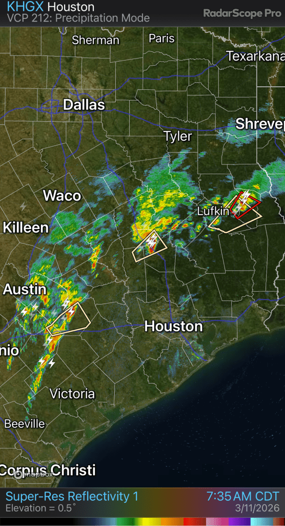
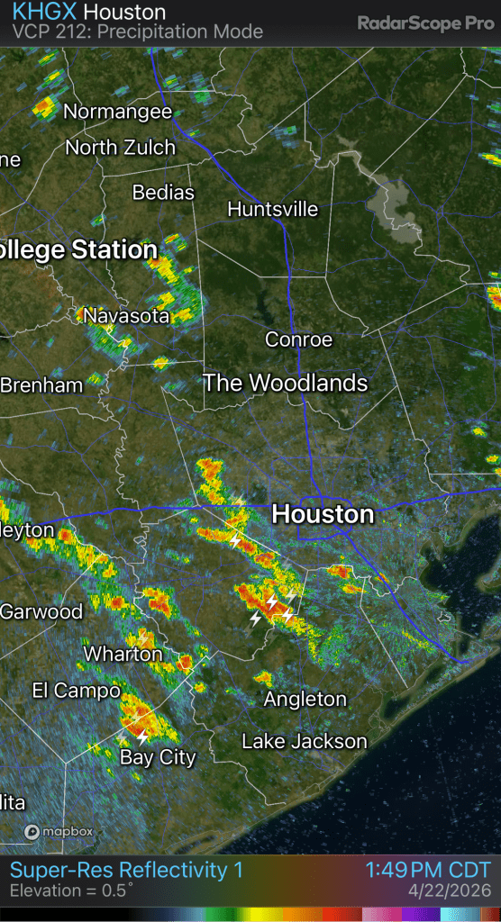
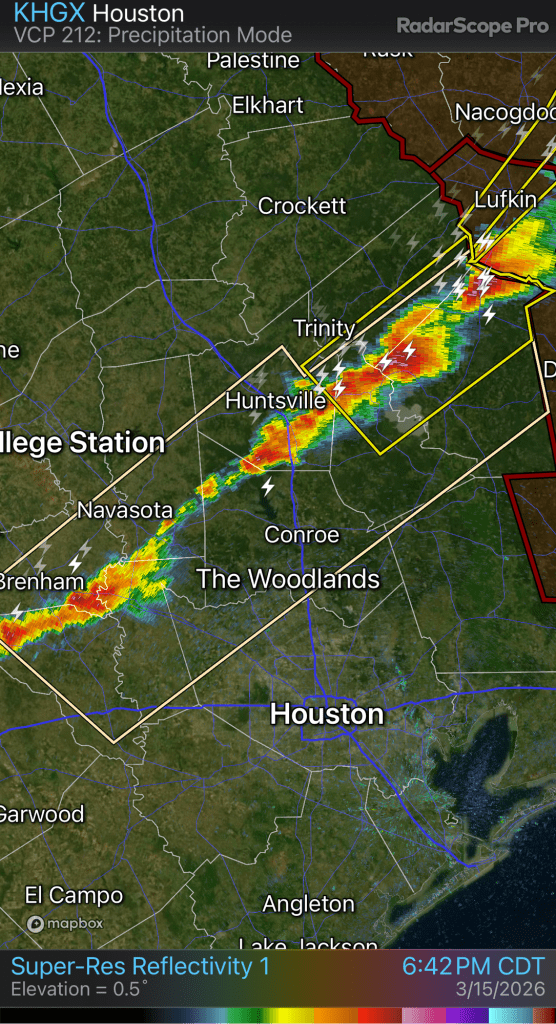
It’s pouring here. Up to 2.37” already. Expect flood warnings later today as the rain totals pile up.
So far, the band of heaviest rains are just north of the I-10 corridor.
It’s pouring here. Up to 2.37” already. Expect flood warnings later today as the rain totals pile up.
So far, the band of heaviest rains are just north of the I-10 corridor.
The last several days have featured a lot of severe weather across North Texas (and states to the north and east).
All the warm air across Southeast Texas has been fueling these storms up north.
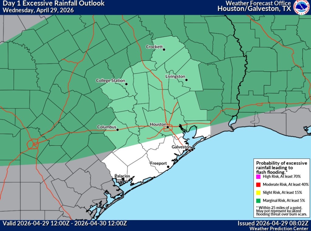
Starting today, things will shift south and begin to impact Southeast Texas. A cold front will approach the area this afternoon and stall near the I-10 corridor. We should see thunderstorms develop along and ahead of the front this afternoon once daytime heating can overcome the cap.
The front will stall and drift north before a stronger cold front heads this way on Friday.
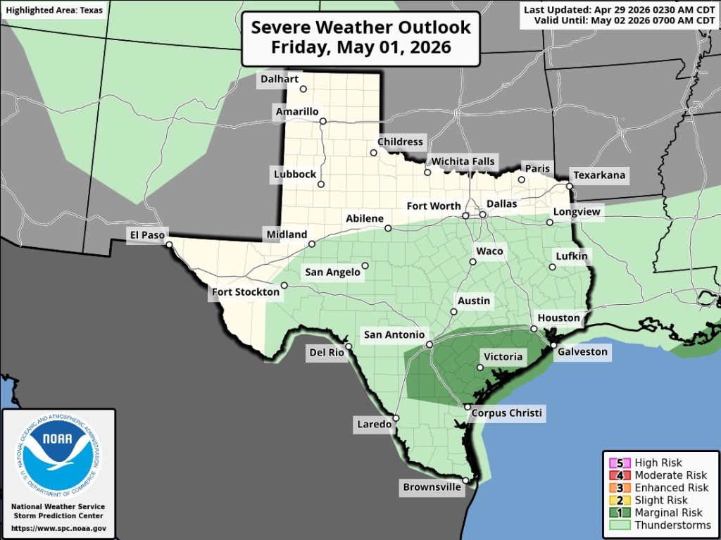
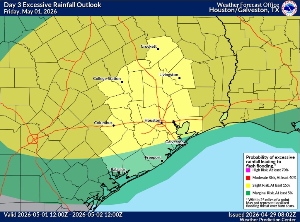
Friday will feature an even better shot of widespread showers and thunderstorms across the area and an enhanced chance of localized flooding.
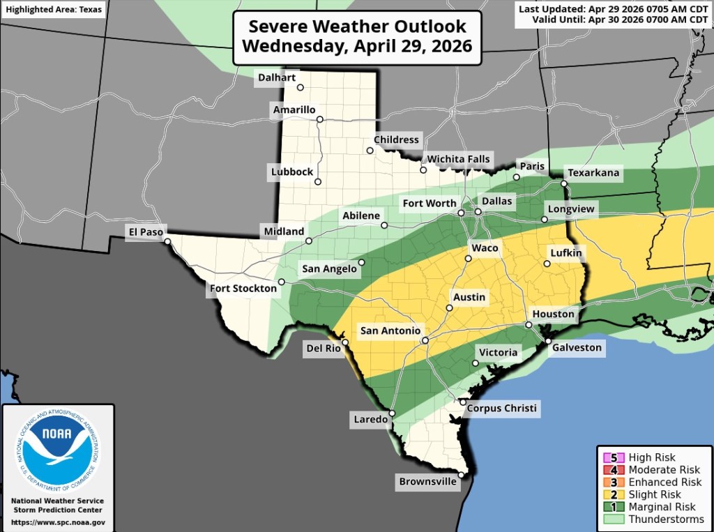
The storms today and Friday will both bring a chance of severe weather, heavy downpours, and isolated flooding wherever storms begin to train over the same area. The Storm Prediction Center and the Weather Presenter Center have placed the area under a risk for severe weather and flooding. Today and Friday are days to keep a watch out for any severe weather watches or warnings.
After Friday’s front, this weekend will bring yet another reminder that summer isn’t here quite yet. We will have a refreshing shot of lows in the 50’s and highs in the 70’s for a few days.
Enjoy it while it lasts, as next week will see temperatures climbing again. Probably to stay.
Jason Schlitz
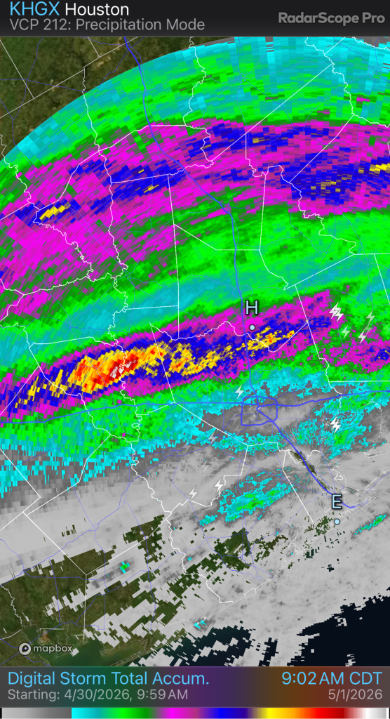
We’ve been in a wet pattern for several days and it looks like more storms are on the way this afternoon.
Thunderstorms with heavy rain are already developing as the atmosphere heats up. The storms should move generally to the NNE and will starting moving into the Houston area soon.
The storms will bring some heavy downpours and there may be some flooding where storms reform over the same area, or ‘train’ in a line over the same place.
Jason Schlitz
It’s been a busy week with family and Easter activities, but I finally had some time to post an update.
Last week’s rainfall was much welcomed. We received 1.5” of rain at the house.
The cold front ushered in the coolest weather we will see until the fall. I hope everyone enjoyed a few amazing days of blue skies and low humidity.
As you’ve noticed, the humidity is back and we already have some showers and thunderstorms off to the southwest.

We’ll see a good chance of rain tomorrow and there could be some thunderstorms in the afternoon. Most of the severe weather will stay north of here.
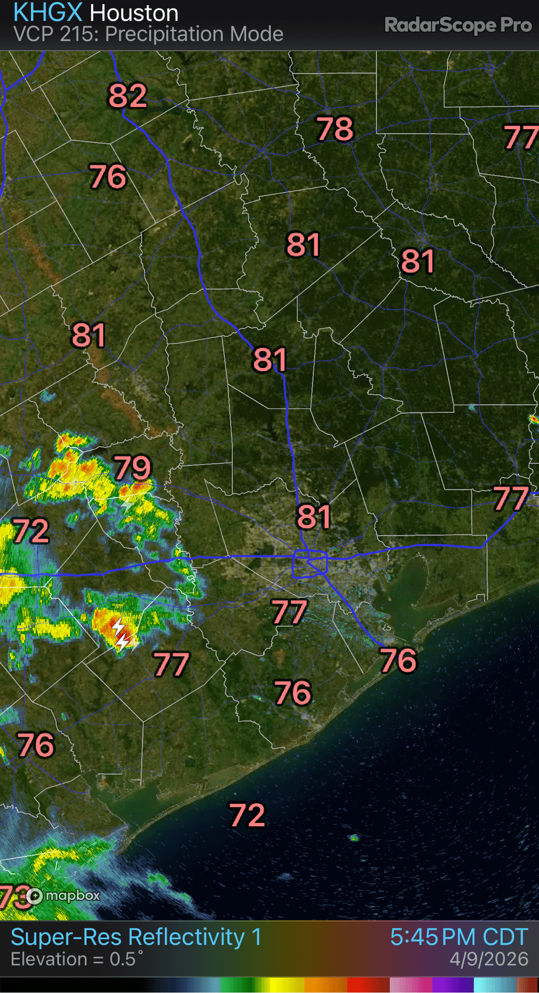
This weekend will be cloudy and humid, with about 50/50 chances for rain and highs in the low 80’s. The upcoming pattern will feature some additional chances of rain, with warm and humid weather.
By the following weekend, we may be back into the 90’s.
It’s been a long time since we’ve seen any rain, but a pattern change should finally bring some relief.
The next couple of days will be very similar to today. Temperatures will be warm and humid, and we’ll see clouds rolling-in from the south, especially in the early morning hours.
Wednesday going into Thursday will feature our first shot of rain. Nothing too heavy is expected, but anything is welcome.
By Saturday evening, a cold front will approach and then pass through Saturday night. This will bring another chance of rain to the area. It’s too early to specify the exact timing of the rain and rainfall amounts, but expect a decent chance of some storms along the front Saturday evening and then some post-frontal showers overnight into Sunday morning.
The rain should move-out on Easter Sunday leaving us with a cool, breezy day behind the front. Easter morning plans could be tricky for outdoor pictures so keep an eye on the forecast as the details become clear.
After that, we may have some more opportunities for beneficial rainfall but the heaviest activity could stay up north towards DFW. We have plenty of time to see how next week plays out but hopefully we can start to break away from the ongoing drought.
Jason Schlitz
I hope everyone enjoyed our last reminder of winter. A heat dome is building and the heat is on!
The next few days and this weekend will feature a massive heat dome building over the Southwest US. Places like Phoenix will experience record highs. This heat will set all-time record highs for the month of March across the desert southwest.
Houston will be on the eastern edge of the heat dome. While we won’t be as hot as Arizona, we will feel it. We should see 90’s across the metro area on Saturday and Sunday. Under mostly clear skies, we won’t see a drop of rain for a long time.
We should cool off a little next week as the heat dome weakens and shifts away. In the meantime, stay hydrated and take it easy in the heat.
Jason Schlitz
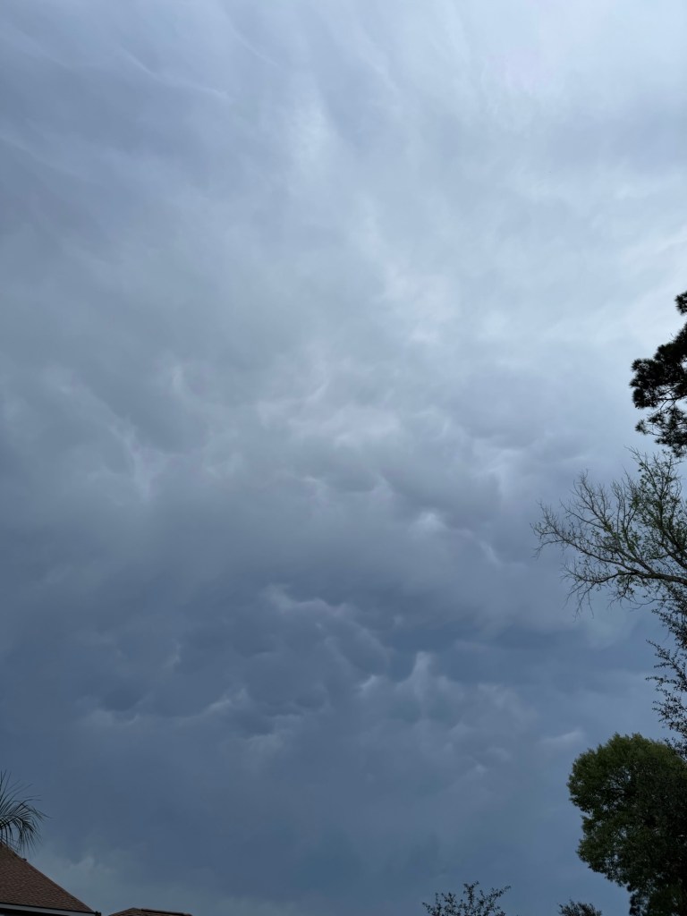
We have a broken line of storms approaching the Houston area along the cold front.
North of the house, we have Mammatus clouds forming. They look like bubbles of clouds dropping down. They are indicative of severe weather.
Keep a watch out for any warnings and strong gusty winds incoming.
Jason Schlitz
Just a reminder a strong cold front will move across Southeast Texas late this afternoon and into tonight. Should be moving into the Houston area around 5-7pm. The winds behind the front will be very gusty, so secure your lawn furniture, or anything else that could blow around in the wind.
Jason Schlitz
Happy Saturday everyone. It’s March and that often brings wild swings in the weather. This weekend will feature a pair of warm days with highs in the 80’s. Tomorrow night, a strong cold front will plow through Southeast Texas with gusty north winds.
Monday will feel a lot cooler with highs topping out in the 50’s. Monday night will be chilly with lows in the upper 30’s. This may threaten (or break) some record lows and I wouldn’t be surprised to see some frost on the rooftops and exposed areas. It would probably be a good idea to protect your most tender tropicals, like plumerias.
A warming trend begins next week and we’ll be back into the 80’s by Thursday or Friday.
A major heat dome will be forming out west and we may find ourselves in the 90’s by next weekend.
If you like cooler weather, enjoy tomorrow’s front because that appears to be it for a long time.
Jason Schlitz
Good morning. Some of us experienced some rain showers overnight. There were even some claps of thunder under the strongest storms.
The overnight showers were a sign of more to come. A pair of cold fronts will move through Southeast Texas later today. Before they arrive, the atmosphere will continue to destabilize and heat up. This may allow some of the storms to become severe, but the bulk of the severe weather will stay off to our north and east.
After the front, expect a few days of beautiful spring-like weather. We’ll have highs in the 70’s with low humidity – perfect weather for Southeast Texas.
Keep a watch out later today but it shouldn’t be too bad for most of us.
Jason Schlitz